In the words of the Birmingham office of the National Weather Service, “The next 6-7 days are gonna be quintessential Alabama weather, and a perfect example of why we must ALWAYS be prepared for anything here in the South.”
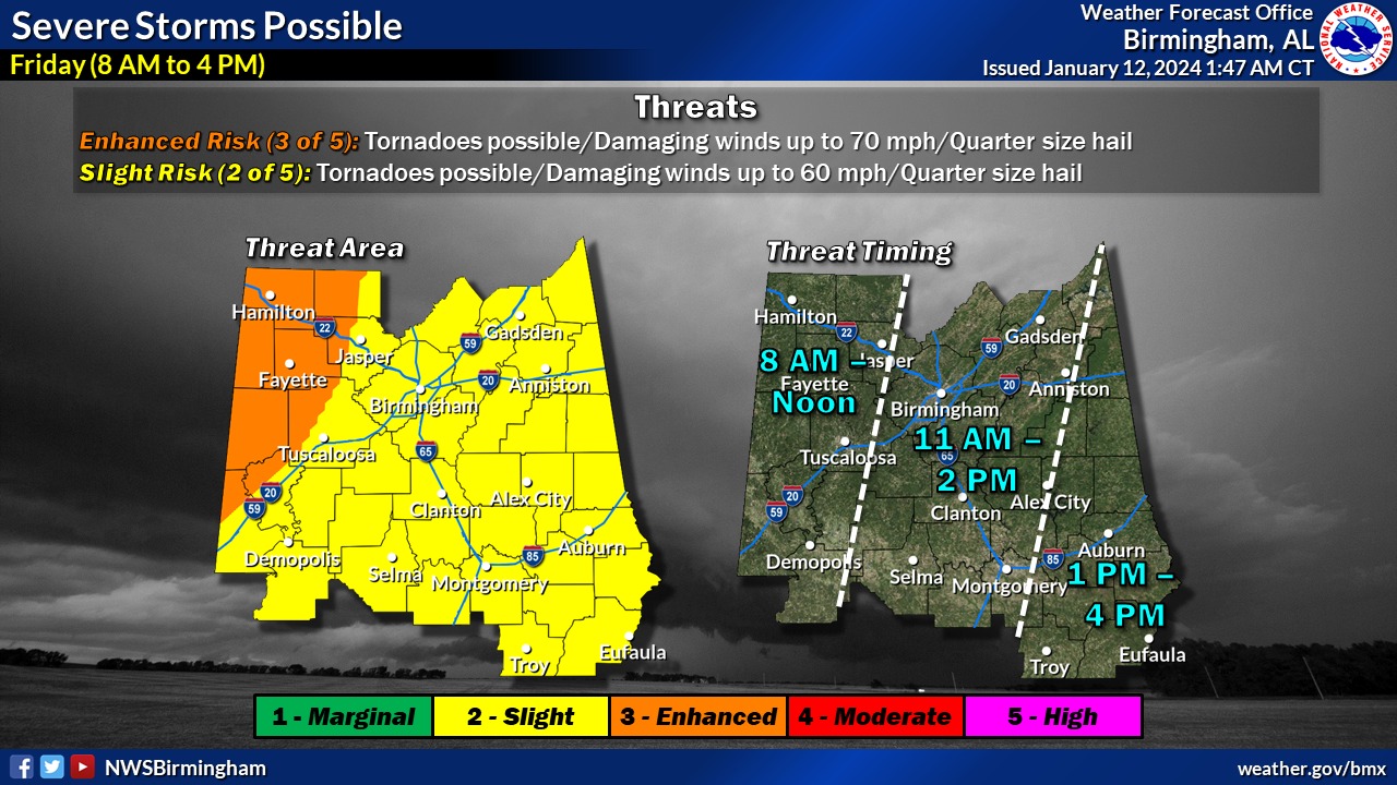
A quick-moving line of storms will cross the state this morning and during the afternoon, bringing a risk for damaging wind, tornadoes, and hail, the office said. Winds outside the thunderstorms will gust up to 45-50 mph, and a wind advisory is in effect until tonight.
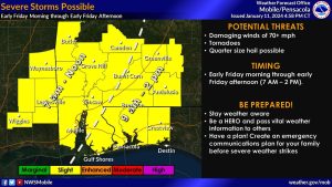
In south Alabama, the Mobile office of the NWS also is forecasting strong to severe storms this morning into early afternoon. The storms can produce “a tornado or two, damaging wind gusts, and large hail.”
:The expected timing is 7 a.m. to noon west of I-65 and 9 a.m. to 2 p.m. east of I-65.
Outside of thunderstorms, strong wind gusts can be expected across the forecast area with frequent gusts of 40 to 50 mph from 6 a.m. to 6 p.m. Strong winds could blow around loose objects and make driving difficult for high profile vehicles.
Offshore over the marine waters strong winds frequently gusting to gale force around 35 to 40 knots and seas of 6 to 9 feet can be expected from 9 a.m. through 9 p.m.
(National Weather Service Mobile Facebook)
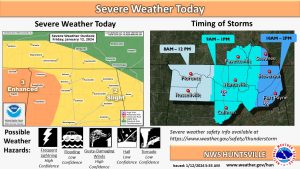
The northern part of the state isn’t going to be spared from nature’s fury, either.
Chances remain very high (100%) for showers and thunderstorms today with a medium chance for storms to become strong to severe, the Huntsville office of the National Weather Service said.
“A line of strong to severe storms will push into the area later this morning,” the office said. “Damaging straight-line winds will be the greatest risk, along with a low chance for hail and tornadoes.”
(NWS Huntsville Twitter)
All of this is in advance of a a bitter cold arctic air mass that will arrive Sunday night in the Yellowhammer State and persist at least into the middle of the upcoming week.
The office said highs will drop into the mid to upper 20s by Tuesday. Lows in the single digits to mid-teens are forecast Monday and Tuesday.