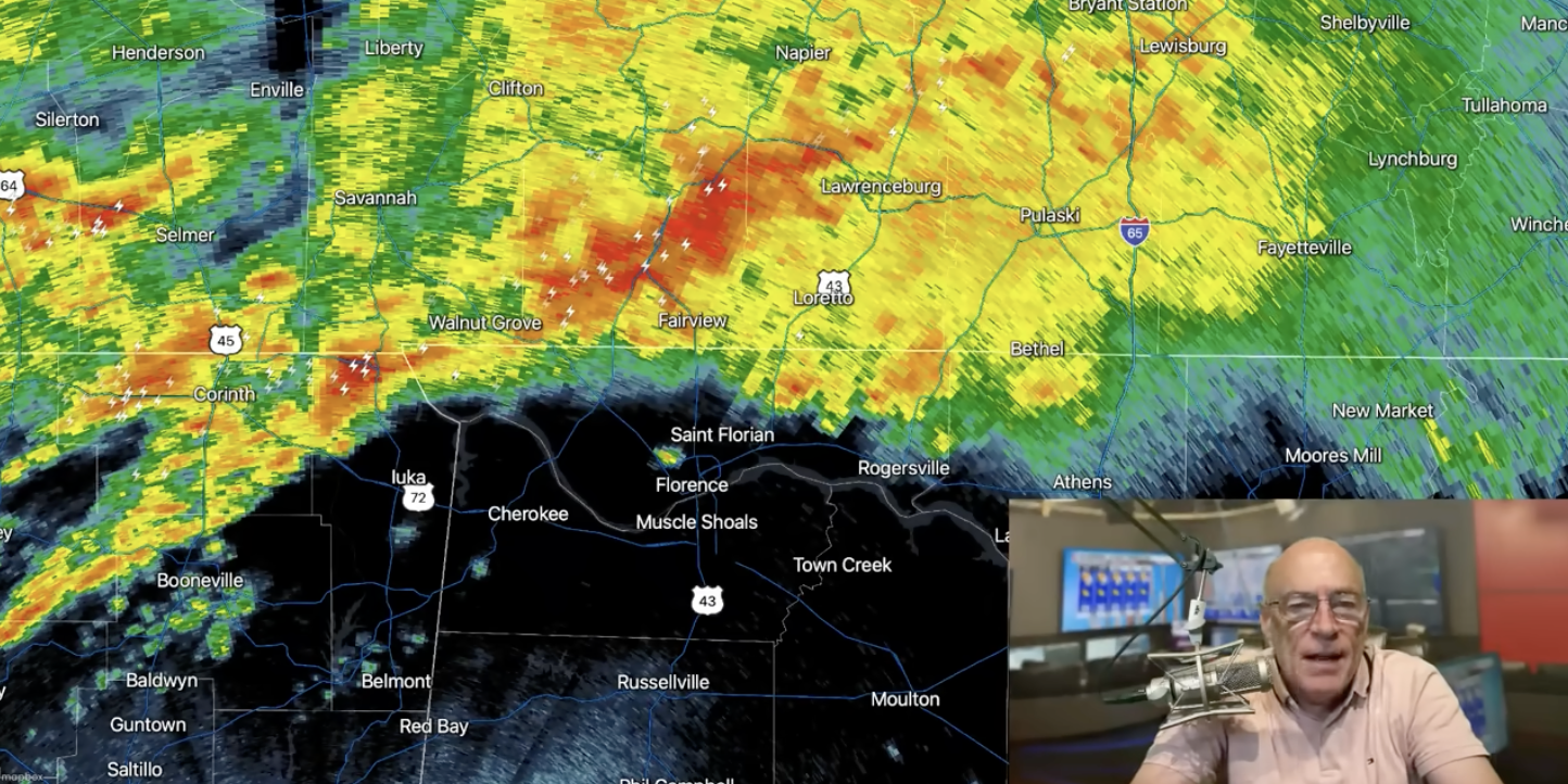
RADAR CHECK: Rain is falling this morning over far North Alabama, near the Tennessee state line, but the rest of the state is dry. Highest risk of rain this morning will remain across the Tennessee Valley, but showers and storms will develop and expand southward this afternoon and tonight.
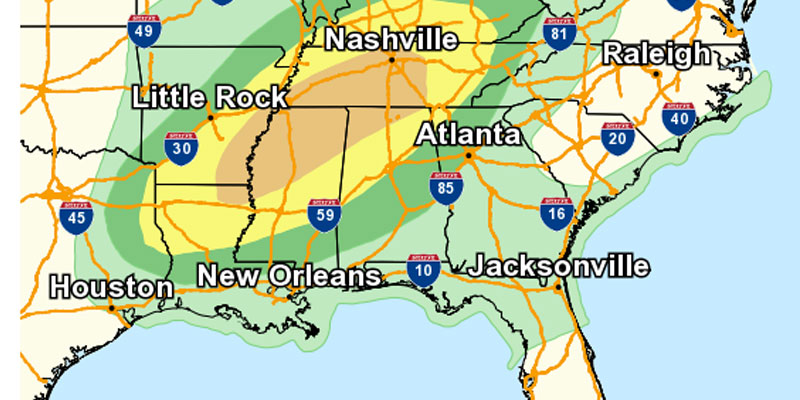
SPC maintains an “enhanced risk” (level 3/5) across parts of Central and Southwest Alabama… this includes cities like Birmingham, Tuscaloosa, Sylacauga, Clanton, Brent, Greensboro, Demopolis, Eutaw, York, Butler, and Aliceville. A level 2/5 risk covers the northern 2/3 of the state, and a level 1/5 risk is up as far south as Mobile and Dothan.

Here are the key messages….
*Timing has been adjusted to show an earlier start to the severe thunderstorm threat. Severe storms could develop over the northern and western counties as early as 1:00 p.m.
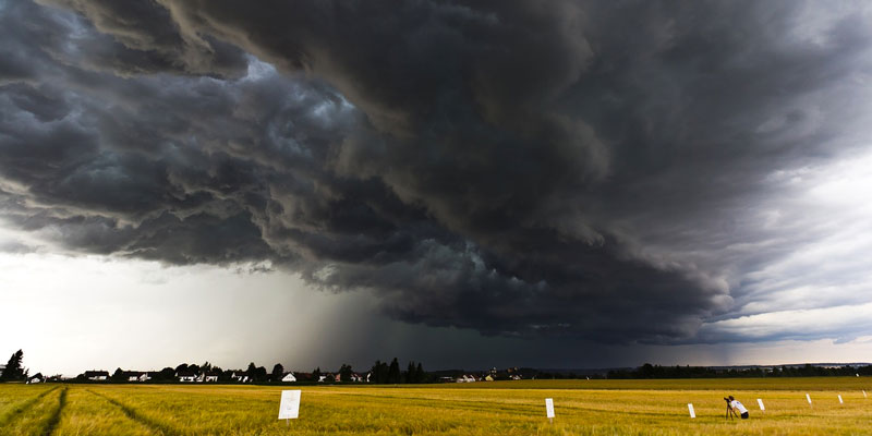
*The main risk of tornadoes is in the “enhanced risk” area across the central and southwest counties this afternoon and tonight.
*Also keep in mind storms will also be capable of producing hail and strong straight line winds as they move through.
*These storms will be very efficient rain producers, and some flash flooding problems could very well develop.
*Be sure you have a good way of hearing severe weather warnings. If you live in a mobile home, know the location of the nearest shelter (or business that can serve as a shelter), and have transportation arranged.
Storms will slowly weaken after midnight as they push into the southern half of the state, but a low end severe threat will continue during the pre-dawn hours tomorrow. The northern 2/3 of the state will be dry most of the day tomorrow, and rain will end over the southeast counties by mid afternoon. The day will be cooler with a high in the low to mid 70s.
FRIDAY AND THE WEEKEND: Most of Alabama will remain dry during the day Friday with just a few isolated showers near the coast. A wave of low pressure will form on the front in the northern Gulf, and rain will be possible Friday night into part of the day Saturday over the southern half of the state. North Alabama will likely be dry Saturday, but the sky will be mostly cloudy.
Sunday looks wet and unsettled with a good chance of showers and thunderstorms with the approach of another upper trough/surface front. Then, much of next week looks rain-free. See the video briefing for maps, graphics, and more details.

ON THIS DATE IN 1967: An EF-2 tornado tore through the western part of the city of Birmingham that Saturday evening, just west of downtown… some of the heaviest damage was along Lomb Avenue, near Rickwood Field and the GES store (the Walmart of the day). One person was killed, and 25 people were injured along four mile path. Two homes were destroyed and sixty damaged. Another thirty industrial buildings were damaged.
Look for the next video briefing here by 3:00 this afternoon… enjoy the day!
Courtesy of Alabama Weather Network