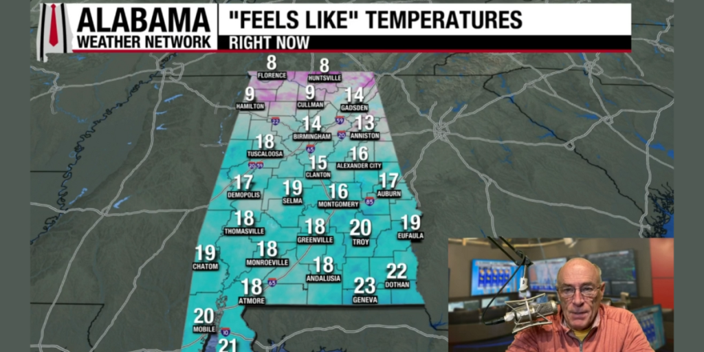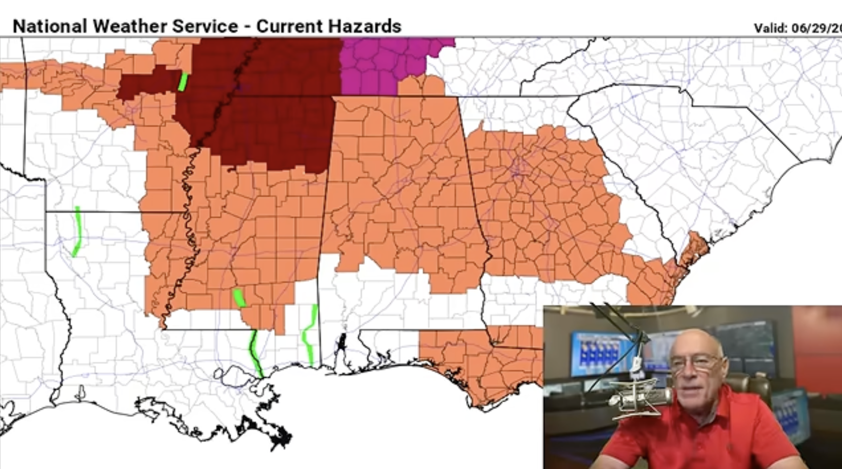
HOT SUMMER WEATHER: An upper ridge will bring the hottest weather so far this year to Alabama and the Deep South this week. Highs will be in the 90s with heat index values reaching the single digits. Cooling showers will be almost impossible to find this afternoon.
A wave rotating around the base of the upper high, moving in from the east, will bring the chance of scattered showers and thunderstorms to the southern 2/3 of the state tomorrow afternoon. It won’t rain everywhere, but a few spots could see a decent downpour over the central and southern part of the state.
Then, afternoon showers will be very isolated for the latter half of the week.
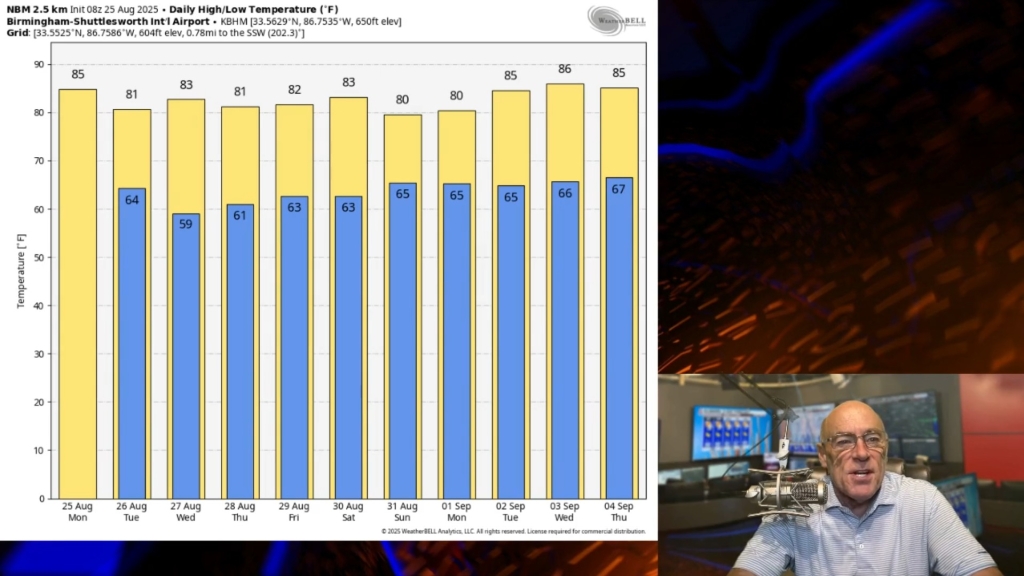
FOURTH OF JULY WEEKEND: The weather stays hot and humid, but the core of the upper ridge will begin to weaken and shift westward. Heat levels will drop slightly, and the door will be open for the usual risk of “widely scattered, mostly afternoon and evening showers and thunderstorms”. Highs will be in the 90-95 degree range, and odds of any one spot seeing an afternoon showers are 20-30 percent.
NEXT WEEK: Heat levels will be down with highs in the 87-92 degree range. And on daily basis we have the risk of random, scattered showers and storms generally between noon and midnight. See the video briefing for maps, graphics, and more details.

TROPICS: Disorganized showers and thunderstorms located near the coast of North Carolina are associated with a mid-level disturbance and an approaching frontal system. A broad area of low pressure is forecast to form along the front offshore of the southeastern coast of the United States in the next day or two. Gradual development is possible while the system drifts southward and then westward before environmental conditions become less conducive later this week.
Chance of development is only 10 percent, and the Gulf stays quiet over the next 7-10 days.

ON THIS DATE IN 2012: One of the most destructive, fast-moving severe thunderstorm complexes in U.S. history carving an 800-mile path of destruction from Indiana all the way to the Atlantic coast in less than 12 hours. A small cluster of storms in Iowa rapidly evolved into a massive, forward-propagating bow echo, known as a derecho. It caused 22 fatalities and left more than 4 million customers without power—making it the largest non-hurricane power outage on record at the time. Compounding the disaster, a brutal, prolonged heatwave gripped the region during the subsequent week-long grid restoration.
Courtesy of Alabama Weather Network.