Researchers at The University of Alabama have led a far-reaching new study examining flood exposure across the United States, finding that more than 17 million people face the most severe levels of potential risk.
The research, published last week in Science Advances and reported by Fortune and The Associated Press, evaluates coastal areas stretching from Texas to Maine using a wide range of environmental and demographic data.
Instead of relying on a single measurement, the team combined numerous indicators—including physical flood hazards, infrastructure exposure, and population characteristics—along with historical loss data from the Federal Emergency Management Agency.
Advanced modeling tools were then used to estimate overall flood vulnerability.
The analysis determined that roughly 17.5 million people fall into the most severe risk category, while a similar number are considered one tier below that level.
The Alabama-based research team said the study’s strength lies in its ability to bring together multiple dimensions of risk into a single framework, offering a broader view of how flooding could impact communities.
“We brought together multiple dimensions of flood risk that are often studied separately,” said co-author Wanyun Shao, a climate scientist at UA, in comments reported by The Associated Press. “Those numbers are shocking, are alarming.”
By incorporating social factors such as income levels, age, and access to resources, the study aims to capture not just where flooding may occur—but who is most likely to be affected.
The findings point to several major metropolitan areas where large populations are exposed to heightened flood risk.
New York City ranks at the top, with millions of residents living in areas identified as having the greatest potential for flooding impacts, along with a substantial number of buildings at risk.
In New Orleans, the total population at risk is smaller, but the share of residents exposed is significantly higher, meaning nearly the entire city could face impacts depending on storm conditions.
Other communities identified include Houston, Jacksonville, Miami, Norfolk, Charleston, and Mobile—illustrating the broad geographic reach of the threat.
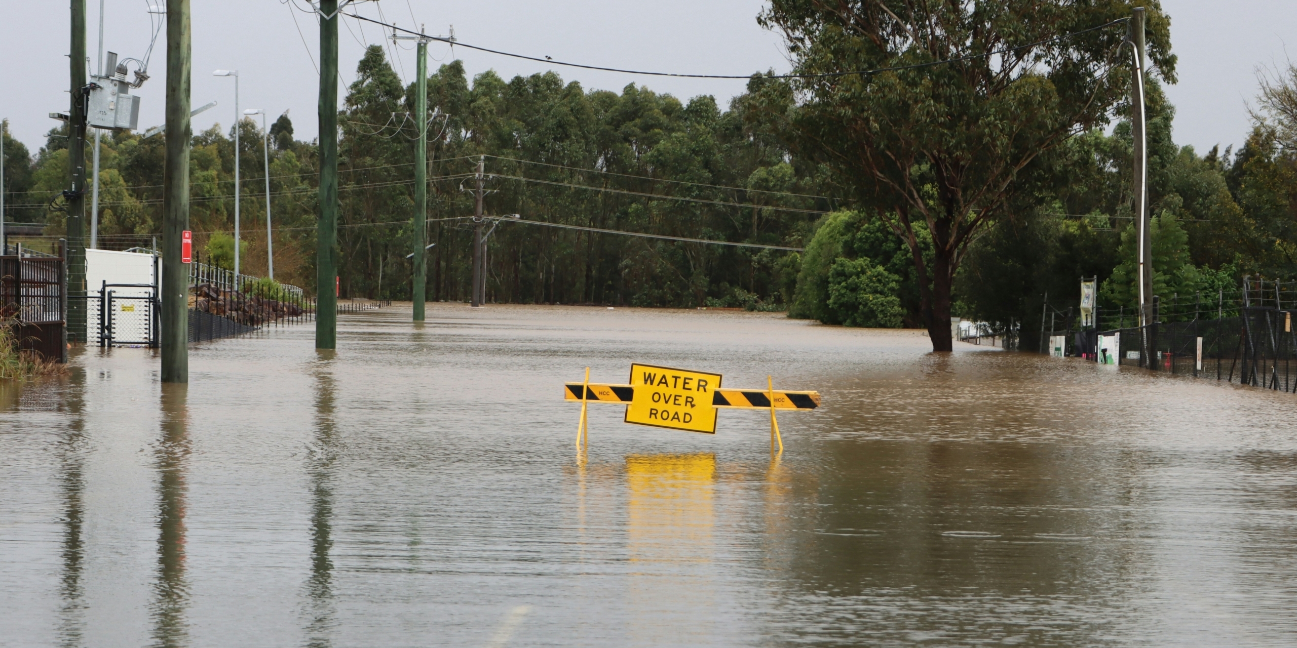
The researchers also evaluated rare but highly destructive flood events, such as those associated with major storms.
Under those conditions, millions of people along the Atlantic and Gulf coasts could face the highest levels of exposure, with many more falling just below that threshold.
The study links rising flood concerns to a combination of environmental changes and development trends.
Issues such as sinking land, dense urban construction, and surfaces that prevent water absorption can all intensify flooding when storms occur.
Experts say these findings reinforce the idea that flood risk is shaped not only by weather, but also by how and where communities grow.
Researchers say the data could help inform decisions by local leaders, emergency officials, and infrastructure planners.
Lead author Hemal Dey suggested that communities consider a mix of traditional protections and nature-based approaches, such as restoring wetlands or improving drainage through green space.
Former FEMA Administrator Craig Fugate said the findings align with long-standing concerns among emergency management professionals.
“The harder question is what we’re actually going to do about it,” Fugate said.
Sherri Blevins is a staff writer for Yellowhammer News. You may contact her at [email protected].