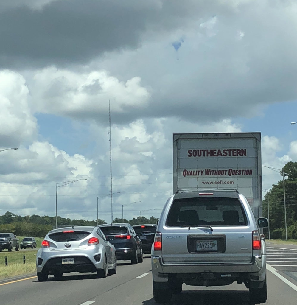
Now that it appears state legislators are licking their chops to raise Alabama’s gasoline tax, the question we all should be asking is, “What are we going to get out of it?”
As 2018 wound down, the push for the hike was aggressive, but details were scarce.
Obviously, we all know the big projects that have gotten the bulk of the media attention: I-565 widened from Limestone County to Huntsville, improvements to I-65 from Birmingham to Montgomery, a southern Montgomery bypass and the much-ballyhooed I-10 Mobile Bay bridge.
To get the ball rolling, here are ten not-as-publicized suggestions (in no particular order) for the state legislature to consider as part of a sales pitch to the public.
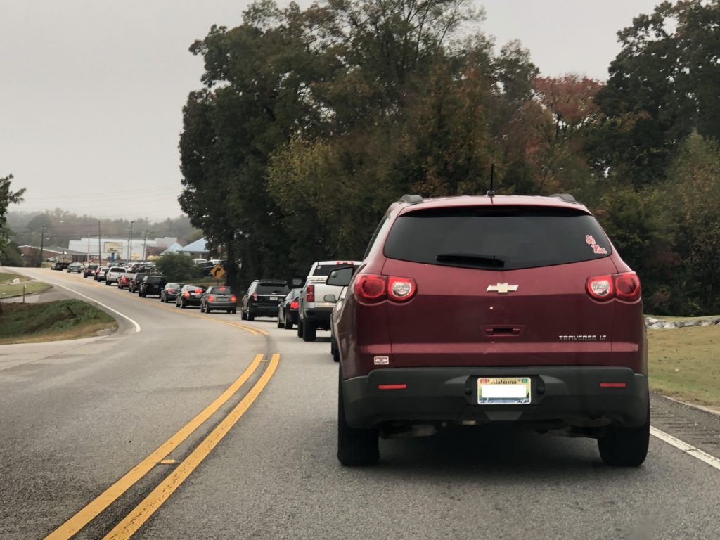
10. Four-lane AL 261 in Pelham, Helena
I can’t believe I’m in my early 40s and we’re still talking about this. For decades, Alabama Highway 261, which extends from Valleydale Road in North Shelby County to the heart of Helena, one of Birmingham’s fastest-growing suburbs, is still a heavily traveled two-lane road.
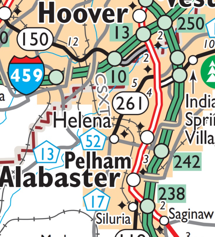
Back-ups are a commonplace heading in and out of Helena at rush hour. Allegedly, ALDOT is finally working to change that, but I’ll believe it when I see it.
Perhaps improvements to AL 261 could work in tandem with four-laning Morgan Road heading northwest from Helena to I-459, or Shelby County Road 17 heading south to Montevallo.
9. Four-lane AL 53 from Ardmore to Huntsville
For whatever reason when they initially laid out the Interstate Highway System, they put I-65 20 miles to the west of downtown Huntsville. And for decades, this has been one of the Rocket City’s biggest obstacles. For those headed south on I-65, there is I-565.
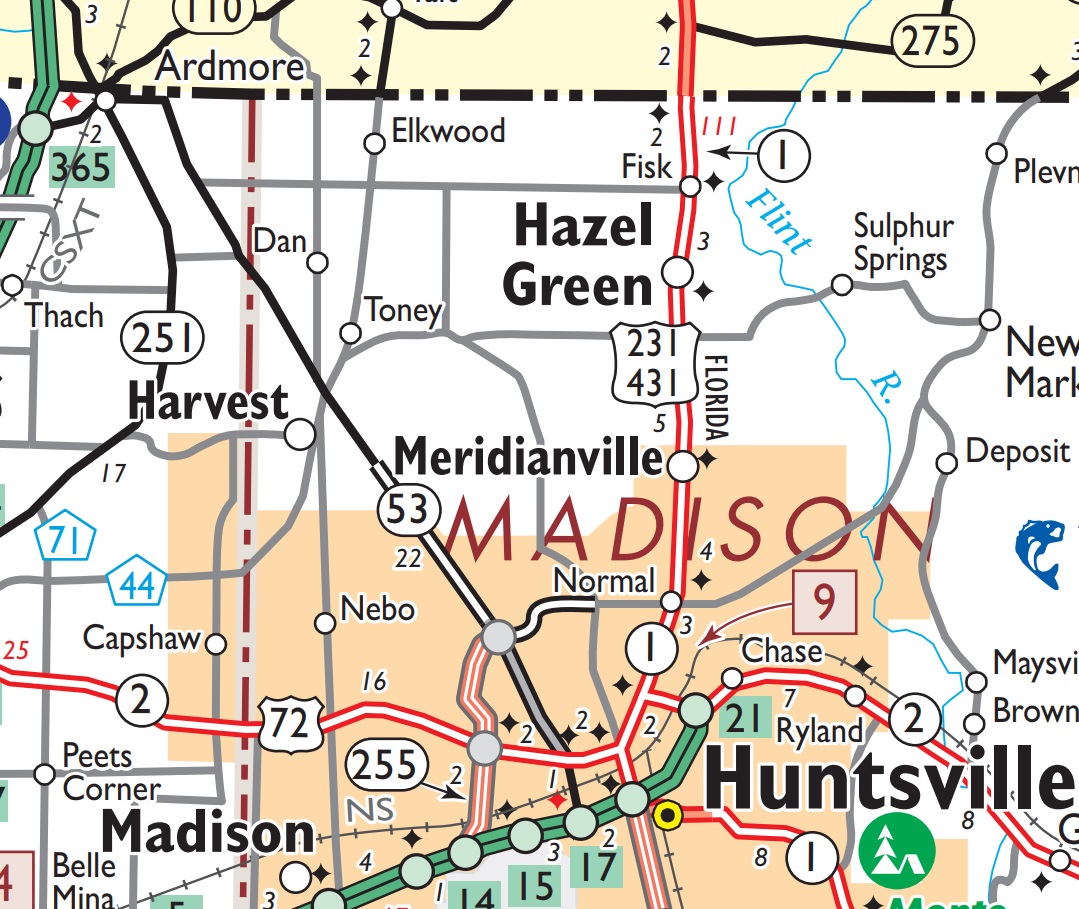
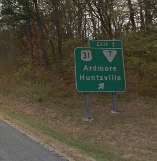
However, for those headed north to Tennessee and beyond, or coming south to Huntsville, there is Alabama Highway 53, a two-lane road that transitions to Tennessee State Highway 7 in Ardmore, a municipality that straddles the Tennessee-Alabama state line.
Coming from Nashville on I-65, the exit is signed for Ardmore and Huntsville. But depending on the time of day, the day of the week, you might be better off continuing south to US Highway 72 or I-565.
8. Improvements to AL186/U.S. 80 from I-85/Wire Road exit to Phenix City
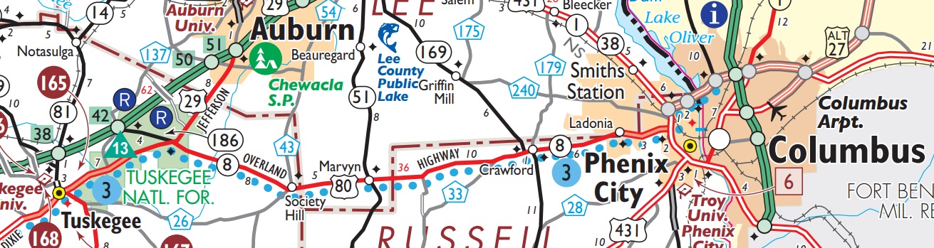
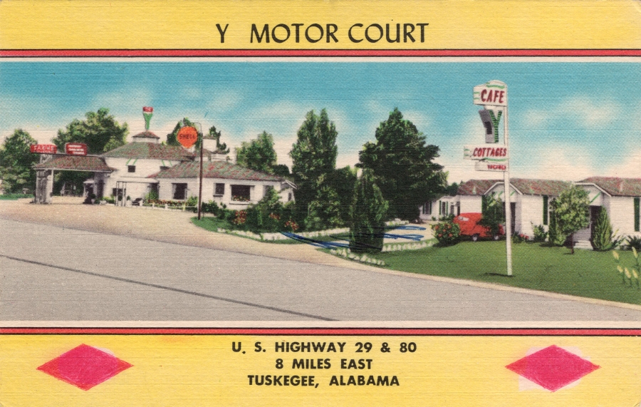
Once upon a time, U.S. Highway 80 was a significant national east-west thoroughfare. Some of it still is, but the Interstate Highway System has made much of it a backroad. If you’ve traveled east from Tuskegee toward Phenix City, you might have seen some of the remnants of U.S. 80’s hay day, where it splits with U.S. Highway 29.
This portion of U.S. 80 remains useful because it connects Phenix City to Montgomery, and, by extension, Columbus, Ga.
Someday, this could be a part of the proposed Interstate 14, a thoroughfare that could pass through the heart of Alabama, running parallel to U.S. 80 from York to Selma to Montgomery to Phenix City/Columbus, and beyond to Macon, Ga.
7. Four-laning U.S. 84 Andalusia to Mississippi line
U.S. Highway 84 in Alabama has been one of the curiosities of the U.S. Highway System. Old Alabama roadmaps show that it has evolved over the past 90 years.
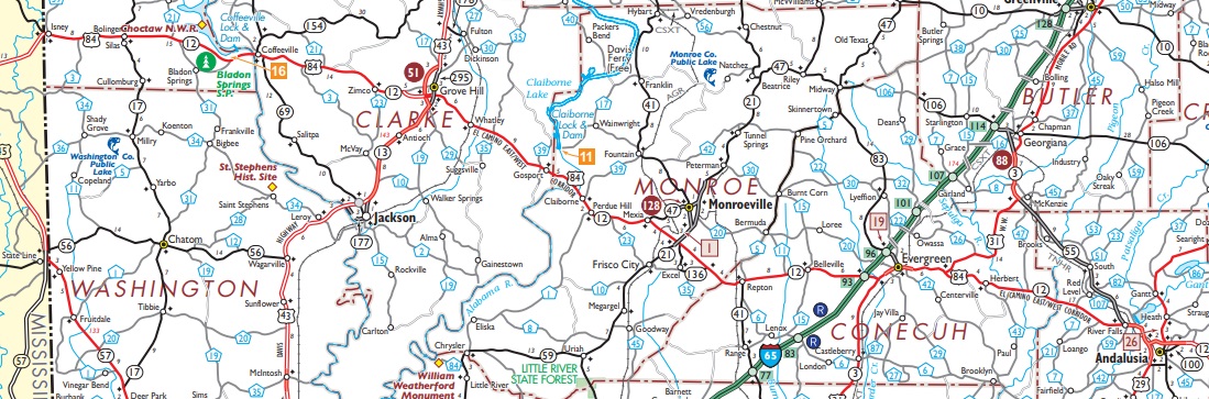
From time to time, portions have been four-laned from the Georgia-Alabama line to headed west. Bypasses for Enterprise, Elba and Opp have been added over the years. But for whatever reason, the progress has stalled west of Andalusia to Mississippi. Once it crosses the Alabama-Mississippi state line, it continues as a four-lane road through Laurel and Brookhaven all the way to Natchez.
Four-laning the road would once and for all connect Monroeville to the outside world by a four-lane highway. Monroe County’s isolation by automobile has been a chronic complaint since the turn of the century.
It would also connect Choctaw County to the rest of Alabama, which functions more as part of Mississippi these days given its proximity to Meridian.
6. Dothan interstate connector to I-10 in Florida
Whenever there is talk about a new Interstate highway, Dothan residents’ eyes perk up, and the local media take notice.
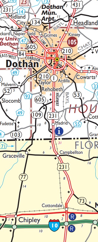
Throughout its history, Dothan has been somewhat fortunate with its highways. There are five different four-laned routes in all directions, like spokes on a wheel, from Ross Clark Circle, the road that functions as a beltway for Dothan.
When U.S. 231 was four-laned as part of the Florida Short Route in the middle part of the last century, there was something of a boom that extended from Dothan into Florida – roadside produce stands, barbecue joints, tourist attractions. Some of that still exists, but now there are also fireworks stands, lottery ticket terminals and bingo, depending on which side of the state line you are on.
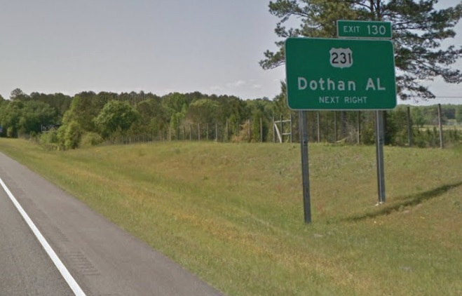
There is a history of that stretch being something of a gateway to Florida for much of the country, and it would be appropriate for some sort of controlled-access spur connecting Interstate 10 to Dothan.
Obviously, this would require cooperation from the state of Florida. People in Houston County seem to want to be connected to the Interstate Highway System, and this might be their best bet.
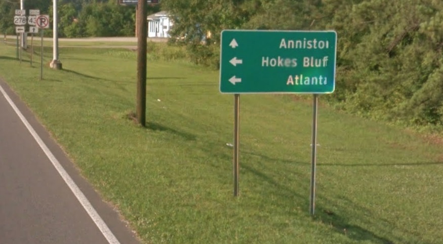
5. US 278 improvements Cullman-Gadsden-Georgia State line
One of the many roads heading west from Atlanta into Alabama is U.S. Highway 278. Initially, U.S. 278 was probably intended to serve as an alternate route to U.S. 78, which passes through Anniston, Birmingham and Jasper, before it reconnects with U.S. 278 in Hamilton.
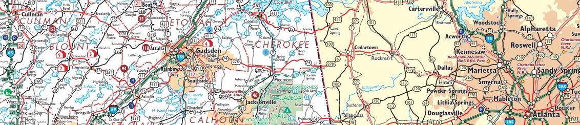
Given easy connectivity to Atlanta is a premium for communities in Alabama, four-laning U.S 278 from the Georgia line to Cullman would better the economic prospects for Cherokee and Etowah Counties. Beyond Attalla into Blount and Cullman Counties, the potential four-lane route would be useful as the Birmingham metropolitan area expands northward.
4. U.S. 331 four-laned from Montgomery to Florida state line
If you’re going to anywhere along 30A in Florida from central and northern Alabama, you’ve used U.S. Highway 331 and traveled through Luverne, Brantley, perhaps Opp and DeFuniak Springs, Fla. Likewise, if you’ve had to evacuate from 30A anywhere north because of the threat from a hurricane, you’ve probably made the reverse journey.
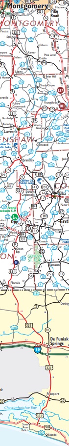
This route is for both tourist and public safety reasons. It also might lend a boost to the local economies along U.S. 331, which are victims of the globalization trend that began in the 1990s.
3. North-south thoroughfare improvements on Baldwin County’s Eastern Shore
One of Alabama’s least-known traffic nightmares is any of the north-south routes along the Eastern Shore of Mobile Bay. On paper, Fairhope is within a stone’s throw of Mobile. But if you’re making that commute up U.S. Highway 98 to Interstate 10 and across the bay, you best allow for an hour of driving time.
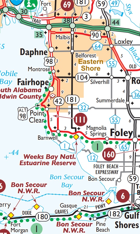
There are several ideas on the table to make this better and improvements to I-10 across Mobile Bay from Spanish Fort will undoubtedly help that commute. A new bridge across the bay may also encourage more development in that part of Baldwin County, which will make getting to I-10 that much harder.
2. Four-lane connecting Huntsville to Georgia state line Atlanta-bound
Now that Huntsville is officially one of the “big kids” of Alabama cities, it is odd that there is not a good way to get from there to Atlanta. Put Huntsville to Atlanta in your GPS, and it’s going to suggest taking some backroads.
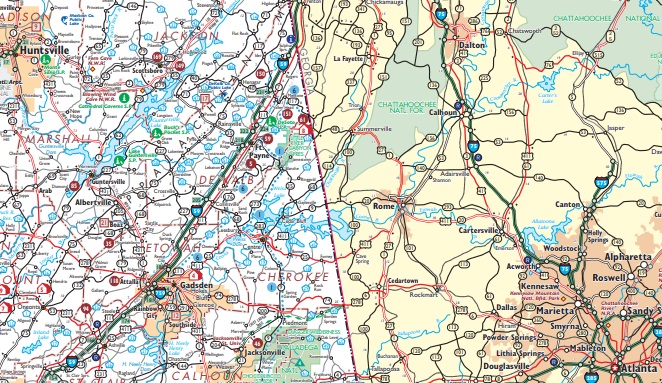
Huntsville is in a geographical predicament. Natural barriers like the Tennessee River and Sand Mountain prevent a bulldozer from making a straight line between the two cities.
If they started tomorrow, a project like this would take decades to complete. The thing is, they’ve already been talking about it for decades.
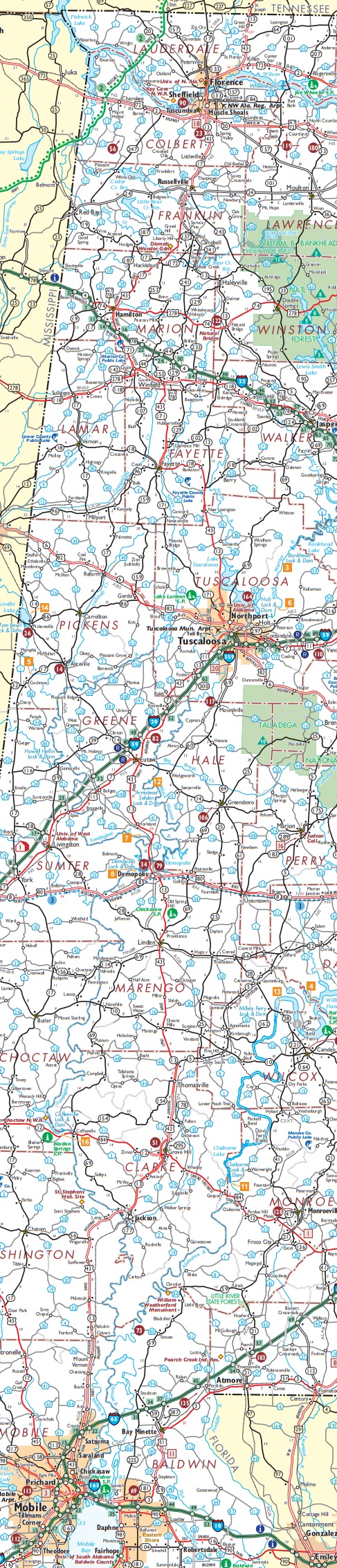
1. North-south freeway, parallel to U.S. 43 from Mobile to I-20/59, and beyond up through NW Alabama to the Shoals
There aren’t shortages of east-west routes in Alabama, but there does seem to be a shortage of north-south routes. Consider the path Interstate 65 takes from Mobile to Birmingham. It isn’t a straight line because it takes a humongous northeastern direction so that it passes through Montgomery. Then it heads slightly northwest from Montgomery to Birmingham.
If you draw a straight line from Mobile to Birmingham, the closest you get to downtown Montgomery is 70 miles. Yet, when they laid out the route for U.S. Highway 31, which was the basis for I-65, it passed through Montgomery.
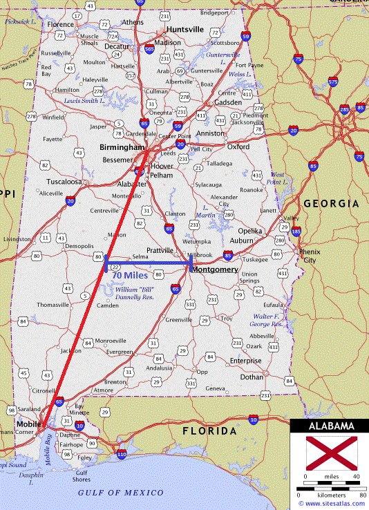
A new north-south route through western Alabama would fix that. If it followed U.S. Highway 43 from Mobile to the Shoals, it could shave time off the journey for those making the trip between two of Alabama’s major cities.
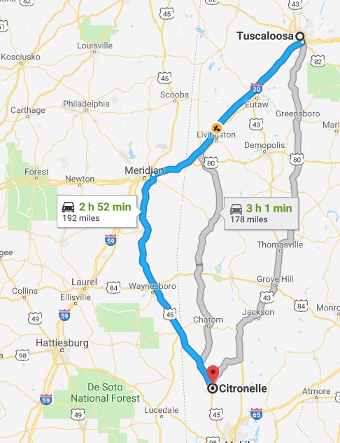
Also, GPS systems sometimes suggest an excursion through Mississippi down U.S. Highway 45 to get to points within the state of Alabama. Yes, to get from Tuscaloosa to Citronelle, the fast way is through Meridian, Miss. and down a four-lane U.S. 45.
The idea of a north-south route through the Black Belt and up through the hill country of northwestern Alabama isn’t a new one. It’s been talked about for decades.
It’s time to show the western half of the state that is north of Mobile and south of Tuscumbia a little love. Granted, aside from Tuscaloosa, there isn’t a whole lot there. However, if we’re going to dump endless sums of money into trying to alleviate poverty in the Black Belt, consider infrastructure, which would be improved access to the rest of the state.
North of Tuscaloosa – ask yourself, when was the last time you were in Lamar County? How about Fayette County? For most, it has probably been a while, if ever. Yet, places like Vernon and Fayette survive as outposts on the Alabama frontier. That seems odd in 2019.

The Tenn-Tomm Waterway, a project which had billions of federal dollars pumped into it over the last half of last century, hasn’t been the expected panacea for West Alabama. Perhaps combined with a controlled-access north-south freeway, that could change and make the areas around Tombigbee River more lucrative for companies looking to build manufacturing facilities.
It is a part of Alabama that sure could use the help.
@Jeff_Poor is a graduate of Auburn University and is the editor of Breitbart TV.