SEVERE THUNDERSTORM/TORNADO OUTBREAK AHEAD: Most of Alabama will be dry, mild, and breezy today, but a dangerous outbreak of severe thunderstorms and tornadoes is expected across a large area beginning late tonight. Alabamians will need to pay very close attention to the weather tonight through Saturday night as a dynamic storm system will bring two rounds of severe thunderstorms.
Round one
- The broad window for the first round of severe thunderstorms will come from around 11 tonight through 8 a.m. Saturday.
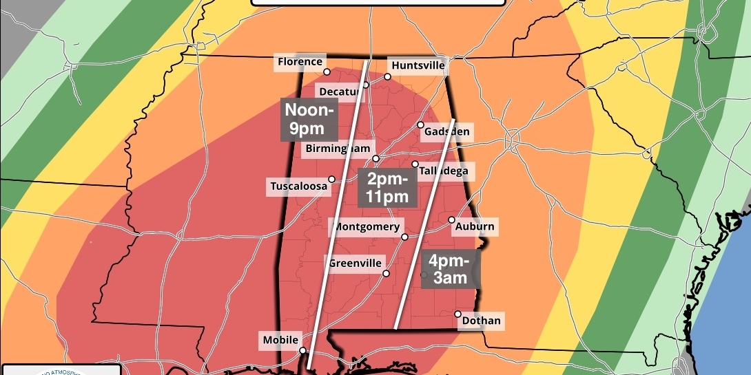
- The Storm Prediction Center (SPC) has defined an enhanced risk (level 3 of 5) for much of west Alabama for this event, with a slight risk (level 2) as far east and south as Scottsboro, Prattville, and Jackson.
- The highest risk of severe storms with round one will be over the western half of the state, mainly along and west of I-65. The severe threat is much lower over the eastern counties, where the air will be more stable.
- Where storms develop, they will be capable of producing hail and damaging winds. A few tornadoes are possible as well, mainly over west Alabama.
Round two
- This is the main event; the window is from noon Saturday through 3 a.m. Sunday.
- A moderate risk (level 4 of 5) covers most of Alabama in the SPC’s outlook.
- Storms will be capable of producing large hail, damaging winds, and tornadoes. A few violent, long-track tornadoes are possible.
Key messages
- We don’t use strong wording often, but in this case, it is needed. The threat is real, and the event poses a dangerous situation for all of Alabama and most of the southern U.S. The goal is no loss of life and no serious injuries; we all have a big role to play.
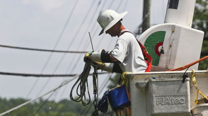
- It is critical that you hear warnings. An outdoor siren is never, ever a primary way of hearing warnings. The “siren mentality” has killed more people than anything else during tornado events in Alabama. The baseline for every home and business is a NOAA Weather Radio; unfortunately, many retailers have sold out of them due to the high demand this week. On your phone, be sure emergency alerts are enabled in notification settings; this is the tone you hear for tornado warnings and amber alerts. Have the free ABC 33/40 weather app installed. Turn the sleep/do not disturb modes off for the weekend so you will receive notifications at night.
- In your safe place, have helmets for everyone, including adults. Most serious injuries in tornadoes involve blunt-force trauma above the shoulders. Wearing hard shoes is also a good idea. Have a portable air horn for everyone; they can alert first responders to your location if you are injured.
- If you live in a mobile home, know the location of the nearest shelter or a business open 24/7 that can serve as a shelter. Have transportation arranged so you can get there quickly. You cannot stay in a mobile home if you are in a tornado warning polygon.
- A car is a death trap during a tornado. If you are driving and get a tornado warning notification, pull off as quickly as possible and go into a gas station, fast food restaurant, or any other business that can serve as a shelter.
- You can be a hero. If you are reading this, you pay attention to the weather. Let friends and family members today know this is a dangerous threat. During the event, if you have a friend or loved one in a tornado warning polygon, call or text them to let them know of the immediate danger. You can play a huge role in saving lives.
- Subscribe to the James Spann and ABC 33/40 YouTube channels so you can watch our live coverage. During the event itself, all of my attention is focused on the live coverage. We are thankful for the out-of-state YouTubers who do long-form severe weather coverage, but to be truly successful in reaching people and communicating warnings in high-end severe weather events like this, you have to understand the people, culture, geography, and microclimate of the region affected.
- We don’t share any of this to scare people. But strong wording is necessary on occasion, and this is one of those times. Get the warnings, have a good plan, and we’ll get through this together.
The sky will clear on Sunday, but a few isolated showers are possible during the afternoon as the upper trough passes through.
NEXT WEEK: Most of the week will be dry, but a cold front will bring a band of showers and storms into the state late Wednesday and Wednesday night. For now, it doesn’t look like a major severe-weather threat.