The National Weather Service’s Mobile office is adding a little levity to its forecast for this week.
?Todays forecast: HOT!
?Tomorrows Forecast: Probably hot but rain may save us.
☀️Thursdays Forecast: The face of the sun! No Hope just send water and towels.
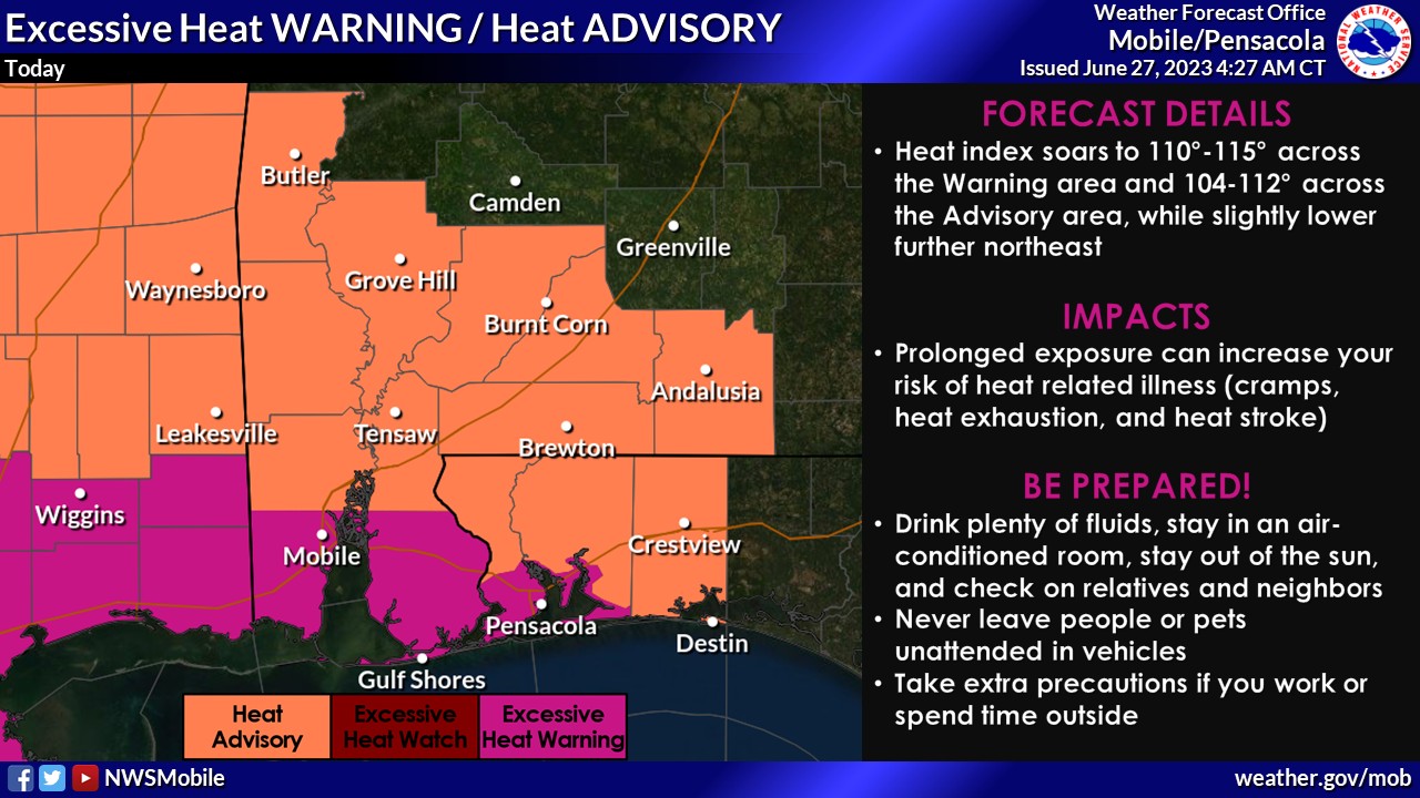
? An Excessive Heat WARNING has been issued for the southern part of the area where the heat index may approach 115. pic.twitter.com/kTLcpP7RJ4
— NWS Mobile (@NWSMobile) June 27, 2023
“I’m sweating just thinking about it,” the office said in its post. “Jokes aside this is some serious heat even for here.
“Please take the heat seriously.”
“Yeah it’s summer, but it’s going to be hotter than typical later this week with the hottest conditions looking to occur from Thursday to Saturday,” the NWS Birmingham office said. “Afternoon highs will be near 100 with muggy/humid conditions pushing the heat index (feels like temperature) to between 105-115.”
- Outdoor activities should be limited; stay hydrated.
- At the beach? Utilize the umbrella and limit time in direct sunlight.
- Do not leave anyone or pets inside vehicles for anytime.