RADAR CHECK: Large areas of rain are moving across Alabama this morning… periods of rain will continue through tonight due to a stalled surface front. Highs today will range from the upper 40s across the Tennessee Valley to the low 60s near the coast.

The sky will stay mostly cloudy tomorrow; best chance of rain will be over the southeast part of the state. Many communities will be dry.
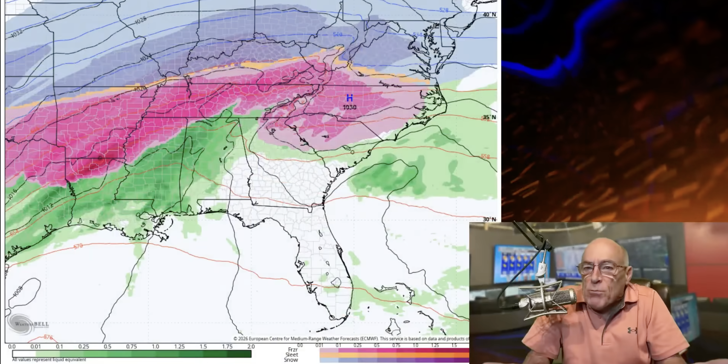
IMPACT FORECAST FOR THE WEEKEND: Here is the impact forecast for Alabama concerning the weekend storm system. Understand this is a complex setup where slight temperature variations can bring major changes in impact. A winter storm watch is in effect for the northern third of Alabama for the weekend. The winter storm watch does NOT include Tuscaloosa, Birmingham, Anniston, or points south.

BOTTOM LINE: For most of Alabama this will be simply a big rain event; greatest risk of ice accumulation from freezing rain will be over the northwest and northeast corners of the state. But, black ice could be an issue for the entire northern half of the state Sunday night and Monday as temperatures fall rapidly into the teens after the rain. Odds of any accumulating snow over the Tennessee Valley are very low, but a few flakes are possible Sunday afternoon.
Ice accumulation for Northeast and Northwest Alabama should be .10” or less; isolated power outages are very possible, but for now we aren’t expecting widespread outages.

Here is a breakdown of impact for different regions:
SOUTHERN 1/2 OF ALABAMA: Occasional rain over the weekend, maybe even a strong thunderstorm in spots. Rain amounts 1-2 inches. But some patchy black ice is possible early Monday morning.
BIRMINGHAM/TUSCALOOSA: Mostly rain; amounts of 2-3 inches are likely. There is a chance the rain could change to freezing rain or light snow before ending Sunday afternoon/evening as temperatures drop rapidly after reaching the 55-60 degree range early Sunday morning. The primary concern for the western half of the I-20 corridor in Alabama is Sunday night and Monday. Temperatures will drop into the teens, and a flash freeze/black ice situation will possibly bring hazardous driving conditions.
HAMILTON/RUSSELLVILLE/FLORENCE: There is a good chance freezing rain will move into the northwest part of the state late Saturday morning, which could result in some ice accumulation. Temperatures will likely be in the 29-32 degree range at the onset of the precipitation.
As the warm sector of the moves northward, temperatures will likely edge above freezing across Northwest Alabama by mid to late afternoon. And it looks like this part of the state will see mainly a cold rain Saturday night with temperatures rising into the mid to upper 30s during the night. This should ease icing conditions.
Then, on Sunday, temperatures will drop quickly and a another period of freezing rain is likely for a few hours. This could lead to more ice accumulation Sunday afternoon. A few snow flakes are possible as well. Black ice is likely on roads Sunday night into Monday morning.
CULLMAN/DECATUR/ATHENS/HUNTSVILLE: While some freezing rain/icing is possible Saturday afternoon with patchy ice accumulation, it looks like temperatures will be generally above freezing with just a cold rain Saturday evening through early Sunday morning. Then, with a rapid temperature drop Sunday, a period of freezing rain or light snow is very possible before it all ends. This could lead to hazardous driving conditions Sunday afternoon through Monday morning.
SCOTTSBORO/FORT PAYNE/GADSDEN/ANNISTON: A wedge of colder air (CAD, or cold air damming) will likely move into the northeast part of Alabama over the weekend from the east, and some freezing rain is possible late in the day or Saturday night. After a brief warm-up with just a cold rain Sunday morning, temperatures drop like a rock and more freezing rain is possible by midday Sunday before it ends. Icy travel is possible Sunday afternoon through Monday morning due to any freezing rain accumulation and the potential for black ice/flash freeze.
Models don’t handle CAD situations very well; the greatest risk of icing from this pattern will be across Jackson and DeKalb counties, but some icing issues could extend down into Etowah, Cherokee, Calhoun, and Cleburne counties as well.
*While a few snow flakes are possible on the back side of the departing rain mass Sunday afternoon in the sharply colder air, snow accumulation in Alabama seems unlikely at this point. Freezing rain and ice are the biggest issues as noted above.
*Temperatures Sunday will fall from the 50s and 60s at daybreak into the 20s and 30s by afternoon. The northern half of the state should be below freezing by 2-3 p.m. Sunday. Icy travel is possible over the northern half of the state late Sunday, Sunday night, and into the day Monday.
*Ice accumulation across North Alabama should be generally 0.10” or less; for now widespread power outages are not expected.
*Colder spots over North Alabama could reach the single digits early Tuesday morning. It will be the coldest morning so far this season.
*Remember, this is a very complex forecast, so watch for updates!

ON THIS DATE IN 1904: An estimated F4 tornado leveled Moundville just after midnight, killing 37 people. The tornado reportedly had a phosphorescent glow. An engineer on a northbound Great Southern train saw the destruction right after it occurred and backed his train 12 miles in reverse to the town of Akron, where he sent a telegram for help.
Look for the next video briefing here by 3:00 this afternoon.
For more weather news and information from James Spann and his team, visit the Alabama Weather Network.