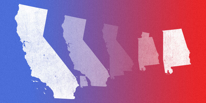
Two recent stories got us thinking about what Alabama might look like if it broke apart.
The first is a New York Times op-ed arguing that the United States is best understood as 11 distinct countries with regional differences that explain voting patterns. Arguments against the analysis aside, it is an interesting concept.
The second story is a drive by a California billionaire to divide the massive state into three separate states, each with its own capital, and each sending two people to the U.S. Senate. The state Supreme Court last month ruled that the question will not appear on the ballot this November.
Still, it is an intriguing thought. So, we put together a map showing Alabama if the Heart of Dixie broke part into five separate states.
A couple caveats, here: This is not actually going to happen. No one has proposed making new states out of Alabama, and even if Alabamians wanted it, Congress would have to approve it.
And regions are arbitrary. We kept the rural counties north of Mobile in the state we label “Gulf Coast,” for instance, even though an argument could be made they don’t belong with the two counties that actually touch the Gulf of Mexico. Autauga and Elmore counties typically are not considered part of the Black Belt, but we included them because we felt they more appropriately belong with Montgomery than elsewhere.
The large state we term “Metro Alabama” includes not just Birmingham and its surrounding counties, but also counties from Mississippi to Georgia. An argument easily could be made that many of those counties belong elsewhere or, perhaps, even should form a different state altogether.
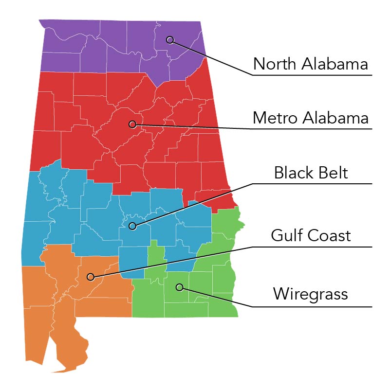
But we had to draw the lines somewhere, and remember — this is just for fun.
Here are the states:
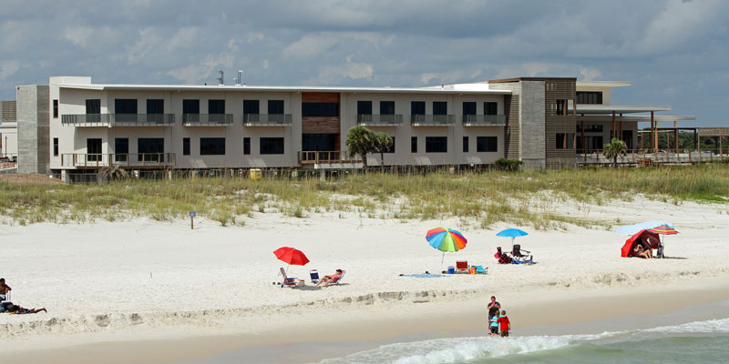
Gulf Coast
The counties: Mobile and Baldwin, plus Washington, Clarke, Conecuh, Escambia and Monroe.
Capital: Mobile.
The Skinny: Gulf Coast would be the state that would take on the character of its capital and biggest city, Mobile. The economy would be based on tourism and manufacturing, with the city’s port retaining its importance to the entire region. The state would have a population of 738,440, based on census estimates. An estimated 14.9 percent of the population 25 and older would live in poverty, slightly above the rate of the current state.
Covering a geography that roughly tracks although exceeds the size of Republican Rep. Bradley Byrne’s congressional district, it likely — not surprisingly — would have conservative voting patterns. President Donald Trump would have won 62.4 percent of this state’s vote in 2016, compared with 34.5 percent for Democrat Hillary Clinton.
Wiregrass
The counties: The state would cover nine counties in the southeast corner of the state — Barbour, Coffee, Covington, Crenshaw, Dale, Geneva, Henry, Houston and Russell.
Capital: Dothan.
The Skinny: Agriculture, particularly peanuts, define this state. Dothan would be both the seat of government and the only major city. In Dothan, the state would have a credible medical hub. The population would be 382,292. That would make it the smallest state in the union — fewer than the 579,315 who live in Wyoming. The poverty rate of those 25 and older would be 15.5 percent. Politically, Trump would have won all but one county and would have defeated Clinton by a margin of 70.5 percent to 27 percent — his best result of any of the new states.
Black Belt
The counties: The state would be those of the traditional Black Belt region, named for its rich soil, plus the suburban counties of Elmore and Autauga.
Capital: Montgomery.
The Skinny: It would be a mix of agriculture in struggling rural areas, balanced by the Montgomery metro area. The population would clock in at 585,501, with a 17.4 percent adult poverty rate. Politically, it is the only one of the new Alabama states that would lean Democratic. Clinton would have carried it by a margin of 52.7 percent to 44.9 percent.
Metro Alabama
The counties: The state would have 25 counties, including all of the Birmingham metropolitan region. It also would include all of the rest of the counties between the southern Alabama states and the sliver of counties along the north.
Capital: Birmingham.
The Skinny: Metro Alabama would be the largest and most diverse of the new states created from the ashes of the old Alabama, with a population of 2,165,612, bigger than 15 current states. Not only would it have Birmingham and its wealthy suburbs, but currently Alabama’s two largest public universities. And it would have plenty of smaller cities and rural areas, too. It would have a 13.8 percent adult poverty rate. Trump’s victory over Clinton in Metro Alabama — 63.1 percent to 33.3 percent — almost exactly matches the results of the current state as a whole in 2016.
North Alabama
The counties: The final of the new states encompasses 10 counties along the top of the current state — Colbert, Franklin, Lawrence, Limestone, Madison, Marshall, DeKalb, Jackson, Lauderdale and Morgan.
Capital: Huntsville.
The Skinny: North Alabama, dominated by Huntsville, would be a major aerospace powerhouse. The second-most populous of the new states, with 1,004,922 residents, it also would be the most affluent, with an adult poverty rate of 12.9 percent. Like most of the new states, this would be solid Trump country. He would have won 67.4 percent of the vote, to Clinton’s 27.8 percent.
@BrendanKKirby is a senior political reporter at LifeZette and author of “Wicked Mobile.”


